How we take your GIS information and use it for greater network knowledge depth
Change country
GIS data, such as pipe networks and valve locations can be imported into RADAR and displayed on the maps. It can be used to assist with deployment planning and for network event source location analysis.
To import GIS data into RADAR it needs to be in an ESRI shapefile format. Shapefiles are a geospatial vector format for storing GIS data that consist of a specific set of individual files each with the same filename but different filename extension.
To upload GIS data into RADAR:
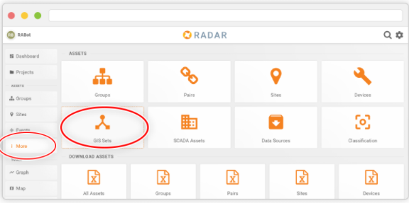
Select ‘More’ from the main menu, and choose ‘GIS Sets’.
Click the ‘Upload GIS’ button and select the .zip file containing the shapefile set.
Click ‘Upload’ to save the GIS file to RADAR.
Once uploaded you can modify the name of the data set, as well as specify the data type.